
Part 4: The Silks to The Lalu..

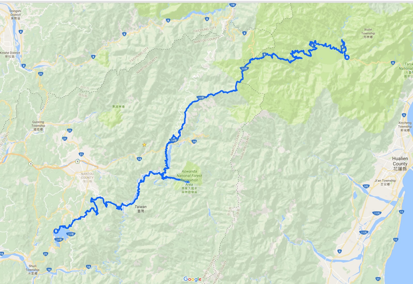
Having spent two days in Taroko, it was time to load my MaxSYM600 and get back on the road. the ride ahead was to be a long one, heading south away from Silks Place and climbing up over Hehuanshan. Hehuanshan lies on the boarder of Nantou county and Hualien, rising 3416 meters to its summit. This section of my journey consisted of over 100km of twisting, winding, climbing and falling road, it was a day for staying focused, on schedule and preferably on the tarmac.
With the sun already heating up the back of my leathers, I pulled the bungee straps tight and programmed my GPS, it was time to get rolling.

There is a definite quandary on a road trip through somewhere so beautiful, the dilemma being the time you have, and the desire to stop and make photographs every minute. Of course I wanted to enjoy the ride as well as the view, so stopping every other kilometre to take in yet another stunning vista had to be put on the less important list. It is easy to let time slip away from you on the road, and I didn't fancy another 2 hours in the dark on a mountain side.


The light was lovely and riding conditions were perfect, so I cracked on a little bit to make time for one or two photographs of this leg of the journey.
Central Taiwan is very mountainous, steep sided peaks rise up blanketed in thick jungle which becomes more forest and eventually grass land the higher you climb. Some of the craggy mountain sides are scared from more recent landslides, all of which adds to the beautiful drama of this landscape.

As i made my way higher along the twisting ribbon of road, several things happened. Firstly I had to stop and put the liner in my jacket as it was getting a bit chilly, secondly the tyre pressure rose and the scooter started to handle slightly differently as a result, finally the performance dropped a little due to the thin air and altitude. Altitude sickness can occur from 2400 meters, my GPS was reading nearer 3000 meters, eventually peaking at 3362 meters. Fortunately I was feeling fine, the view and great road were keeping me more than happily occupied. I just had to try and stay on time.


Up on the highest part of the road, where the air was super fresh, and a steady cool breeze blew over the mountain, I had to stop and enjoy where I was. Pretty much all alone, on top of Taiwan and with the clearest view of the beautiful mountains. No real trees up at this height, just grass and scrub, I could have happily sat for hours.


Sadly though time was a luxury I did not have, and so my charge down the mountain began. The MaxSYM600 is certainly comfortable, however it is not the most agile of machines, ground clearance is not exactly generous. As I peeled off corner after corner, so I peeled of scrape after scrape of centre stand, I just figured I was lightening the load. I had got so used to the noise that it had stopped worrying me too much, but the occasional slip of the rear wheel as a result of grounding out was more unnerving, especially considering the drop off the side of the road.

Having not stopped for a couple of hours, the sun was now starting to get low in the sky. Thinking that I was still making the time and that the GPS was doing it's job, I felt all was ok. Only when I rode through the same small village for the third time did I realised something was not right. Now I started to feel a rise in my stress levels, I hate to be late. Calling ahead I explained I was a bit lost, I knew I was close, I just needed to figure out the correct turning.
Riding all day long on the demanding roads had been difficult, I was mentally and physically drained. Heaving the big and fully loaded scooter around the endless switchback roads had been fun, but it had taken its toll, the last thing I needed was a problem with my navigation system. But that was exactly what was happening. Only a week after I purchased the Garmin, it was beginning to let me down. The Lalu hotel was close, but I just could not get on to the correct bit of road as the GPS sent me around in a loop. Several phone calls later and having given up with the GPS, I was riding to each junction and then checking my phone until eventually I got to the hotel, two hours later than I had aimed for, but I was there and in one piece.

I really wanted a shower after the full day of riding and the added stress of the final section, however it was back to work as soon as I arrived. There was a shot list prepared, and so I had to take a deep breath, gather my energy and get to it. On the plus side, Mrs.L had made her way to The Lalu, she was welcome company indeed.

The following day we were up before dawn and heading to a farm to see the sunrise, there is often a mist which sits low in the valley, it is known as a cloud sea. It wasn't perfect this morning, but what a way to start your day.


Getting back for breakfast, the dawn over Sun Moon lake was beautiful, so peaceful before the tourist boats start to run.

With breakfast finished I got straight to work making photographs around the hotel, not as many as Silks Place thankfully, but a good couple of hours none the less.

Premier Suite


Delicious food.


Relaxing treatments.

Traditional tea ceremony.

Beautiful architecture.

Stunning infinity pool with lake views.
Mrs. L was to join me on the next leg, riding from The Lalu to Tainan and then on to Kenting, but my GPS was now not working at all. I was very disappointed about this and so contacted Garmin. I informed them that I bought the unit a week earlier and now it was not working. Saying they were not helpful would be generous, first they said I had to take the unit back to Taipei to where I bought it, I pointed out that navigation would be a problem and that I was on a work schedule. I asked why I could not take it to the Garmin shop in Tainan and why it is not covered by the global warranty. Again they just said bring it back to Taipei, so I asked how I should navigate, "use your phone" was the reply. I had just got a brand new phone and did not want to use that, plus riding and holding the phone is not really so safe. They then suggested a map, ok but not easy to read as it is in Chinese, and then finally they suggested I stop and ask directions all the way back. Well, I can ask but at the time I would not have been able to understand the answer. Eventually they did accept that I was going to go to the Garmin shop in Tainan. It was lucky that Mrs. L was on the back of the bike to navigate or we would never have made it to Tainan, What happened when we did arrive was far from pleasing, however that is for the next episode.
I hope that you enjoyed this section of the journey, the road over Hehuanshan really is very beautiful and well worth a drive/ride should you get the chance. In the future I think I will camp at the top, spend a night beneath the stars, and wake for the sunrise.
Next time it will be the leg from The Lalu to Tainan, Tainan and also more of the Garmin saga.
Until then, check out my Website, Instagram , Tumblr, Twitter and Linkedin. Remember to LIKE COMMENT and FOLLOW.
Feel free to get in touch, if you have any questions, bookings, assignments etcetera, I am always interested to hear from you (contact me).
Love to all...
One last thing (which is amazing), my blogs are now becoming available in Chinese and can be found here.
No comments:
Post a Comment